
The Proof is in our Work
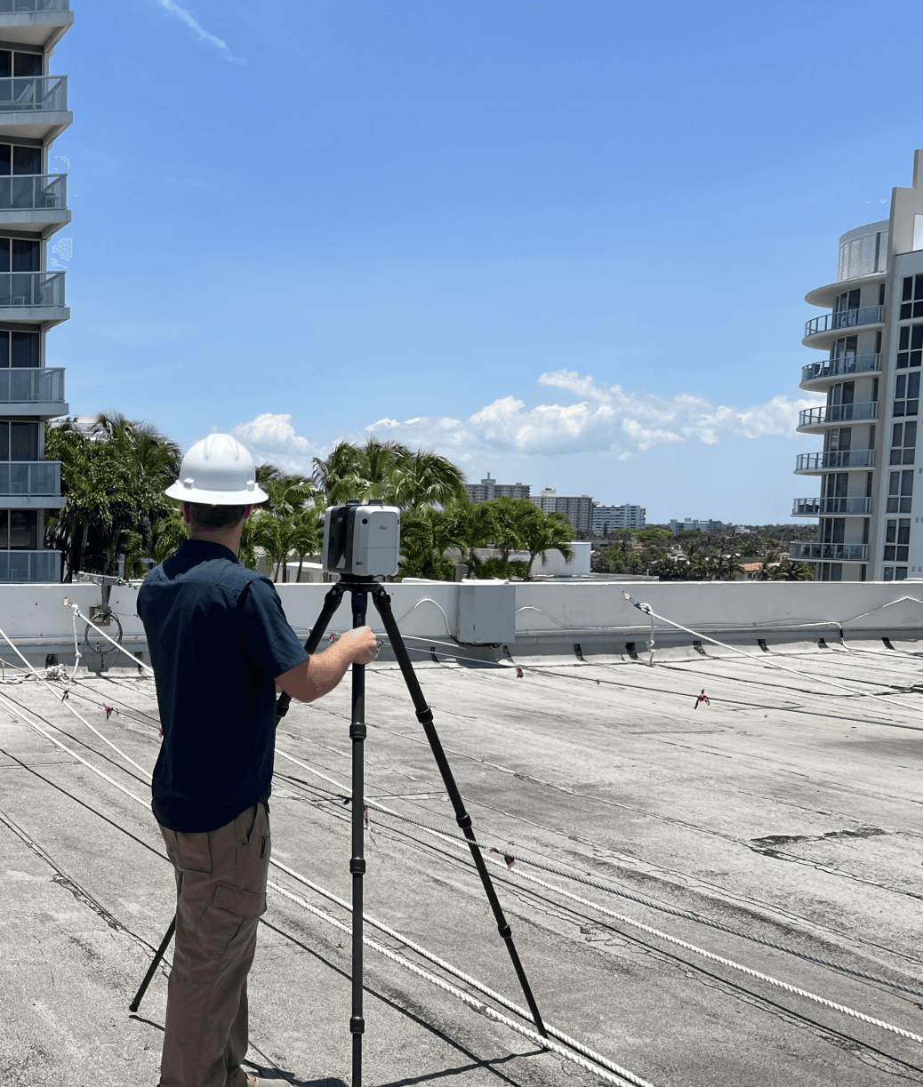
A Point cloud is a type of 3D model consisting of millions of individual points. Each point contains a bit of information such as its location in 3D space, and color. From this cloud model, extremely accurate measurements and records can be made and conditions such as settlement monitoring, deviations from design, locations of in-slab structural elements and much more can be recorded and analyzed.
Using the latest survey-grade LiDar scanning equipment and trained technicians, we provide the highest quality of laser scan on the market today; with uncompromising accuracy. Included in our service, you will receive the Point Cloud model hosted on a web platform that allows you to view, measure and collaborate on your scan project.
-
![]()
-
![]()
-
![]()
Recent Projects
More ProjectsEvery project comes with its own needs and challenges. Tell us your priorities, and we'll fill them to your satisfaction.
-
![]()
Services
Structural Settlement Monitoring
Taking multiple scans per year, we then overlay the point cloud models, finding any deviations between scans to highlight changes in location & orientation of critical structural elements. With erosion and settlement an ever growing concern in our coastal Florida market, our yearly settlement scan package will take the guesswork out of structural settlement monitoring.
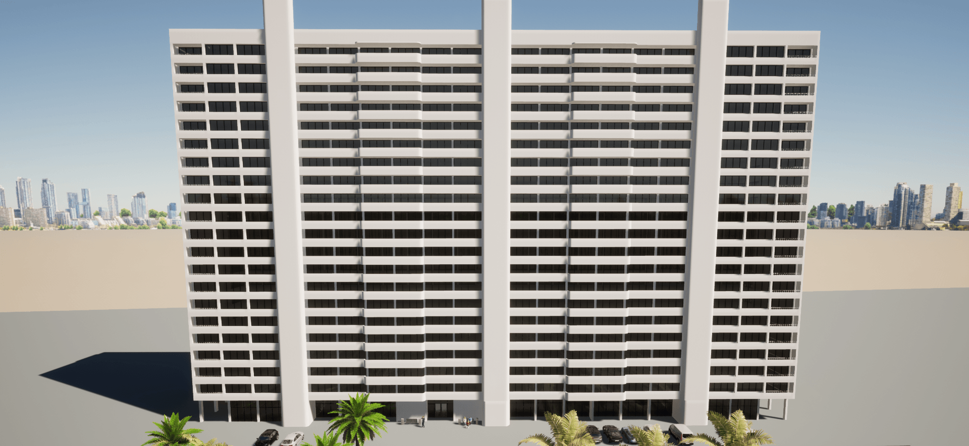
Scan to BIM
After collecting a highly detailed point cloud model, it can be converted into an as-built model, which can be used for coordination, renovation projects, historic preservation, or documentation.
Scan to Plan
By converting the point cloud model into CAD floor flans, design teams can work from a single source of truth with unparalleled accuracy to build smarter without wasting a minute re-visiting
Surface Deviation Detection
Many factors such as wind, rain, salt and sand can damage a building’s facade over time. Buildings located along the coast are especially susceptible to this kind of deterioration. By laser scanning a building exterior, we can visualize the deviations to the surface where stucco or other finishes may be high/low or out of tolerance.
Disaster Documentation
Support Insurance claims with the exacting accuracy of a laser scan as-built condition.
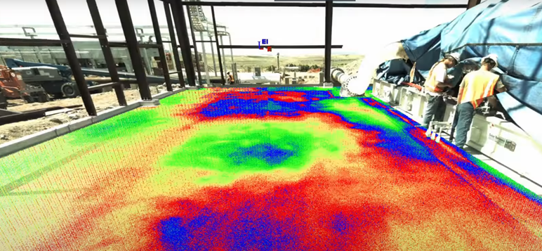
Floor Flatness & Slope Reports
Using any scan containing a floor, we can generate a heat map showing relative high/low spots where puddling, or incorrect slope can be easily corrected.